NO MORE BEST-GUESS DATA
High-Accuracy
Residential Insights
Z-PROPERTY™
3D Property Analytics

150M+ Properties Analyzed by Z-3D™

Improve the speed and accuracy of quoting, underwriting and rating with 3D precision.
View Aerial Imagery
View Aerial Imagery
Extract 3D Property
Extract 3D Property
150M+ Properties Analyzed by Z-3D™
X
To receive information about the 3D insights from Z-3D, fill out the form below:
Thank you! Your submission has been received!
Oops! Something went wrong while submitting the form.
Spin Z-3D rendering with mouse or touch - Imagery provided by Nearmap
VIRTUAL PROPERTY INSPECTION

Essential Property Information Without Stepping On-Site

Schedule a Demonstration
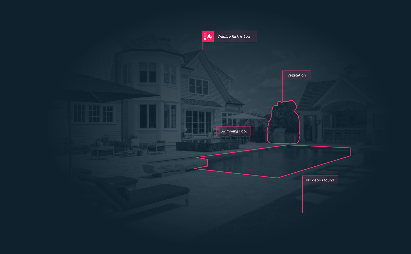
ZESTY.AI DATA PLATFORM

Comprehensive Property Insights

Multispectral Satellite Imagery

Multispectral Satellite Imagery

Multispectral Aerial Imagery

Multispectral Aerial Imagery

Light Detection and Ranging (LiDAR)

Light Detection and Ranging (LiDAR)

Real Estate Transactions

Real Estate Transactions

Building Permits

Building Permits

Tax assessments

Tax assessments

Utility Bills

Utility Bills

Weather

Weather

Topography

Topography

Public Infrastructure

Public Infrastructure

Customer Experience

Real Time Pre-fill of Property Data

Available for both personal and commercial lines.
Geometric background

Benefits

Improve customer experience through real-time data pre-fill

Lower loss ratios through data-driven underwriting

Enable agents to make better risk decisions

Decrease time to quote

Drive customer engagement

Avoid cancellations post-bind due to failed Inspections

Get in touch

Schedule a Demo

Thank you! Your message has been received!
Oops! Something went wrong while submitting the form.